 Among the issues the neighborhood is concerned about is the drainage at Briar Cove. Thank you to all of the neighbors for sending me photos of your concerns that I can publish here. It appears that among the many changes we will be discussing on 9/6 is the change from a smaller development set back 75 feet from the stream to a large development with a retention pond set about 14 feet away from a stream/drainage ditch (terminology is important).
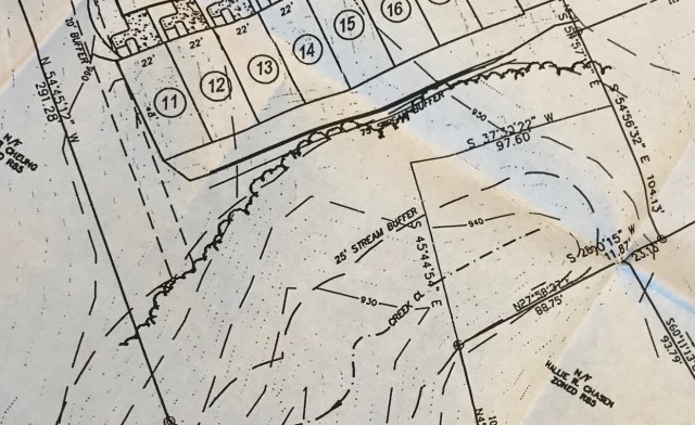
The first question is one of setback. The 2006 plans show the stream running along the property, with the townhouses right at the 75 foot county setback distance. The 2007 plans show the stream has now moved about 75 feet. These plans have been apparently signed off by the engineer from the site who has said that the 2006 stream has been reclassified as a drainage ditch, not a stream. Whatever it is called, we are concerned about the mosquito and stormwater implications of the new plan.
Here is the 2006 setback from the stream:
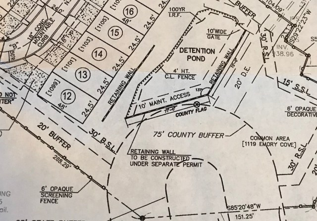
And the 2007 setback. Note the townhouses have not moved, but the stream has moved and a detention pond was added. How does a stream move 75 feet in 1 year? It does seem the stream moved to a convenient spot for building these townhouses.
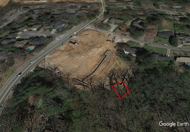
From the satellite, it is even more confusing to figure out the adjustment of the stream from 2006 to 2007. The red square below shows the location of the drainage pipe on top of the creek (pictured below). The county topographic maps don’t seem to match the facts on the ground very well, but even from them it is clear that the detention pond is less than 75 feet from the creek – this is an amateur measurement of course, but it raises concerns and the need for proper review. We can also see from the aerial just how much massive deforestation has already occurred – what will be the impact on the existing drainage from this, and how will the developer replant the trees?
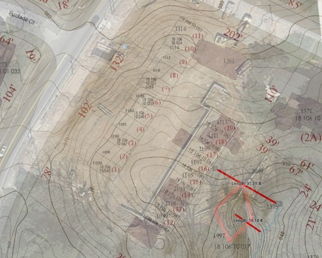
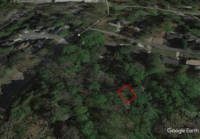
On the ground, what we see is a hill with no vegetation draining into what appears to be a daylight creek less than 20 feet away (or a drainage ditch – it seems to have change). Georgia State Ordinances state that a 25-foot buffer be maintained between the edge of a stream and any new development. DeKalb County requires an additional 50 feet of buffer (for a total of 75 feet). Vegetated buffers near streams provide for filtration of storm water runoff, shade water in streams, and allow wildlife a critical corridor for moving throughout an ecosystem. Any proposed development in the state or county buffer requires a variance from the appropriate agency. If it’s a drainage ditch, then how far is the creek, and what defines those limits? Why does the county topographic map not match the 2006 or the 2007 creek?

The retention has also led to complaints as it does not drain, which led to a neighborhood complaint for mosquitoes.


Dekalb came out and wrote the following:

We would definitely like to better understand the stormwater implications of the reclassification of the stream as a drainage ditch, reduced setback, and mosquitoes in the drainage pond which does not appear to drain. Also, what are the plans for long term treatment of the pond beyond 120 days? Do 2 briquettes of larvicide properly treat a standing pond that is supposed to be flowing and draining? Who will pay for it and make sure it is constantly treated? Will the forest be restored at all?

Thank you for doing all of this research and being sure we understand the implications. Many of us didn’t know there was a stream there! Your question about who will be responsible for the detention pond is a good one. Is there any intervention we can as for from the CDC or the EPA?
LikeLike
Thanks for the nice summary about the construction and the state water running through our neighborhood.
What is in a name? A stream by any other name is still a stream. And no matter what you call it, water and erosion flows downhill. So the stream will win, and everything they have built will fail, we just don’t know when. For those of you interested in how state waters are classified in Georgia, go to the Georgia EPD field guide on classifying state waters (link below). It is complicated and subjective. There are about 20 factors that have to considered including the types of organisms that live in the water, vegetation, topography, etcetera.
Click to access Brochure%20for%20State%20Waters%20Guidance%204-5-17.pdf
LikeLiked by 1 person
That stream runs into the south fork of Peachtree creek. You should get the south fork conservancy involved. http://southforkconservancy.org
LikeLike
Pingback: Commissioner Meeting Stephens/Briarcliff Sept 18 Report – Homeowners Association of South Biltmore (HASoBi)